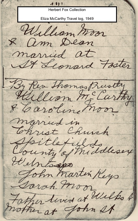
Eliza McCarthy's maternal and paternal lines can be traced to mid-19th century East London in the neighbourhoods of Spitalfields, Christchurch, Shoreditch and Bethnal Green during a generation when British and European immigrants were arriving to the city en masse and settling in the borough of Tower Hamlets. The name McCarthy is of Irish descent, originally from MacCarthach. Broken down, Mac means Son of, and Carthach means Loving. The era in which Eliza's ancestral documents start corresponds with Ireland's 1845 potato famine when a million Irish emigrated to live in Britain or America. But now:
The Irish are the lost wave of immigrants in Spitalfields because they left the least trace. If you walk around Spitalfields, you can see some of the houses where the wealthy Huguenots lived and you can go to the synagogue that’s still there in Sandys Row, and you can visit the Bengali curry houses. But there’s almost nothing to remind you of the Irish except for the sign-writing on Donovan’s paper bag shop in Crispin Street.
https://spitalfieldslife.com/2015/07/04/dont-do-it-magazine/
London's population of one million people in 1800 increased to six million by the end of the century with this steady influx of working class migrants, the East End being a catch-all and making a name for itself in the Weaving Factories, Garden Markets and Industrial Development. Queen Victoria and Prince Albert supported advances towards research in agriculture and newly emerging sciences such as the novel Applied Chemistry. This was lucky for chemist William Perkin who in 1856 accidently discovered the colour mauve in its synthetic form while trying to find an accessible cure for malaria by making a quinine molecule from coal tar byproduct in the attic of his father's house on King David Lane. Once patented, mauve was first used commercially in 1857 by silk dyer Thomas Keith in his Bethnal Green operations. (Mauve, Simon Garfield, 2000).
Eliza's mother, Caroline, grew up with the fabric industry when her father made his living as a Weaver. Caroline's father had passed away by the time she was 23, and the 1871 census shows that she was employed as an Umbrella Trimmer, the family members she lived with also worked in the wardrobe trade as 'Dealer in Boots and Shoes' and 'Dealer in clothes' - professions in salvaging used clothing for re-sale.
Eliza's paternal side favoured construction - the men worked as Brick Layers, Plasterers (wall mouldings) and Locksmiths. Eliza's father, William, was a cabinet maker, a trade he continued when first settled in Canada.
Map of 1882 WhiteChapel neighbourhood with landmarks. Click on the map to view in a separate window
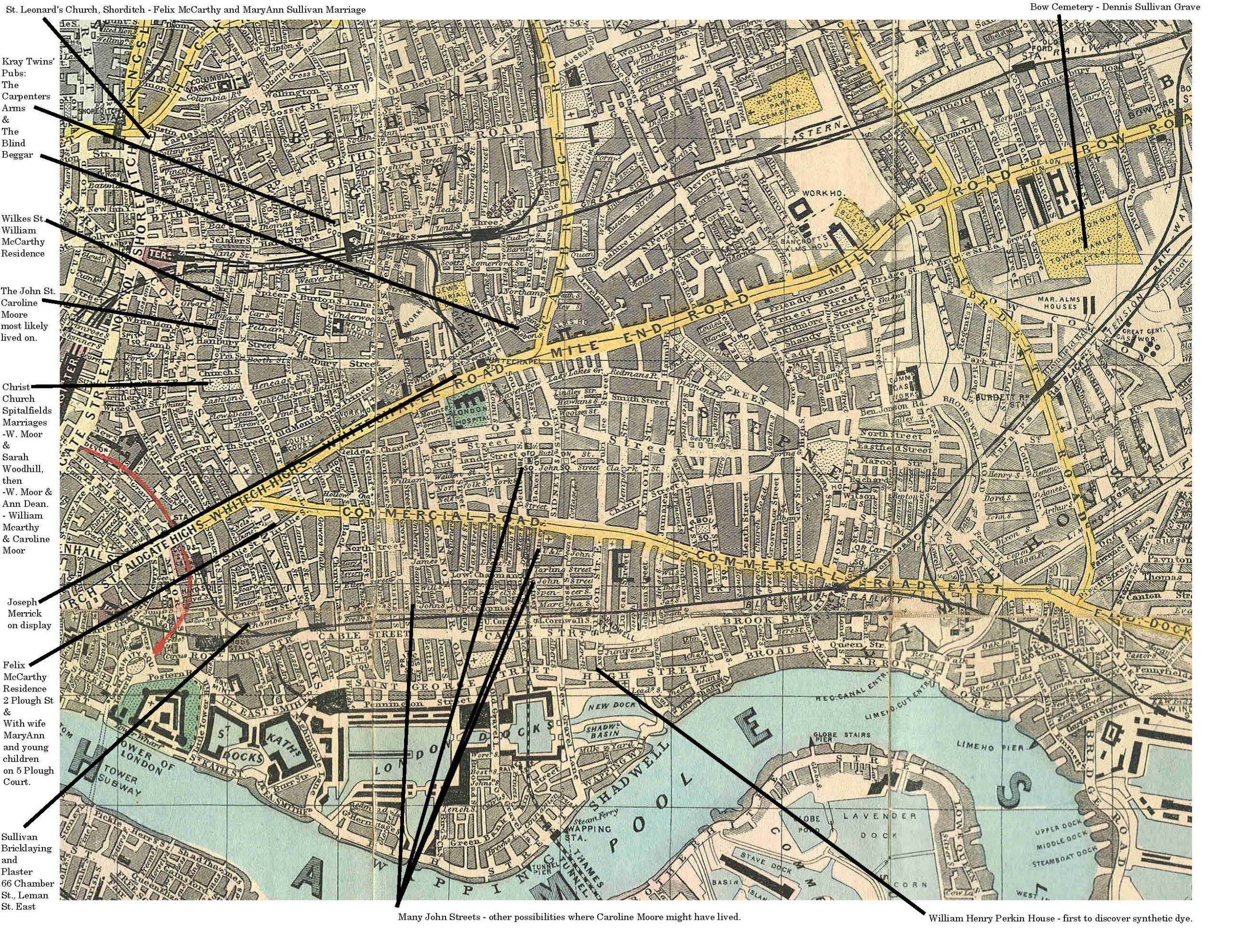 Source: 1882 Reynolds Map of East London Source Birkbeck History Dept. (https://commons.wikimedia.org/wiki/File:1882_Reynolds_Map.jpg)
Alternately, the sensational downsides to a population boom within the city are a polarizing topic. Historical records and popular fiction are dedicated to recording how rough this over-crowded borough was, plagued by poverty and disease and violence forcing desperate acts - the backdrop to many of Charles Dickens' novels; he used to walk in this district and take notes. In 1884 John Merrick (the elephant man) was put on display for the first time on Whitechapel Road in a store across from the London Hospital. When Eliza wrote 'Wilks St.' as her father's address, it was a Wilkes street William McCarthy lived on 15 years before Jack the Ripper terrorized the neighbourhood - the same part of London in which one "Mad Jimmy" Kray grew up and laid forth the stomping grounds for his grandsons, the infamous Kray Twins in the 1950's. https://www.findmypast.co.uk/blog/discoveries/the-kray-family
Spitalfieldslife.com is one website worth a visit because the articles bring together all walks of life in East London. An apt starting point is the photograph collection from John Thompson's street life. The photos were first published in 1876 - a few years before Eliza McCarthy was born, and so the imagery is an intimate route to Eliza and her family's life before they came to Canada in 1885.
https://spitalfieldslife.com/2011/03/28/john-thomsons-street-life-in-london/
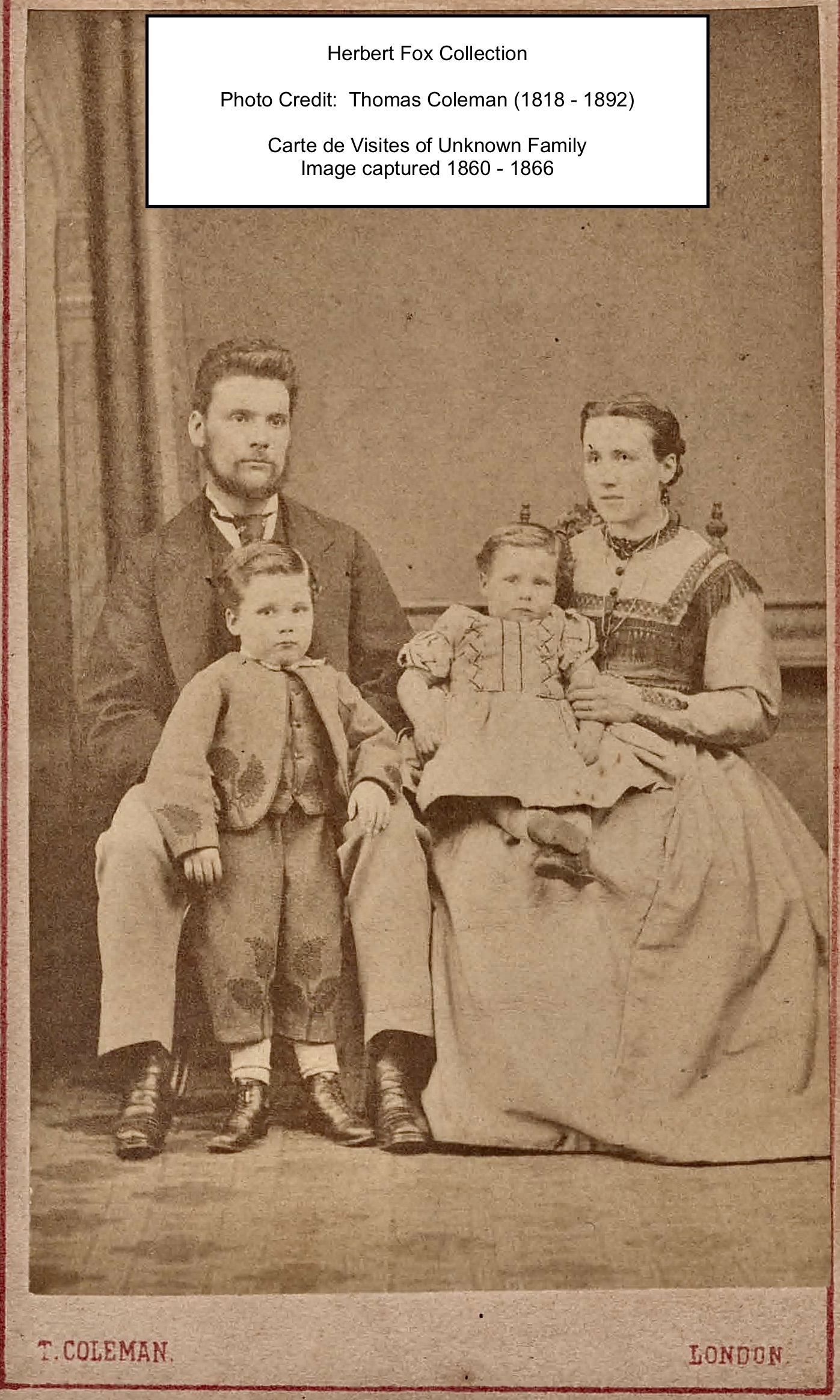
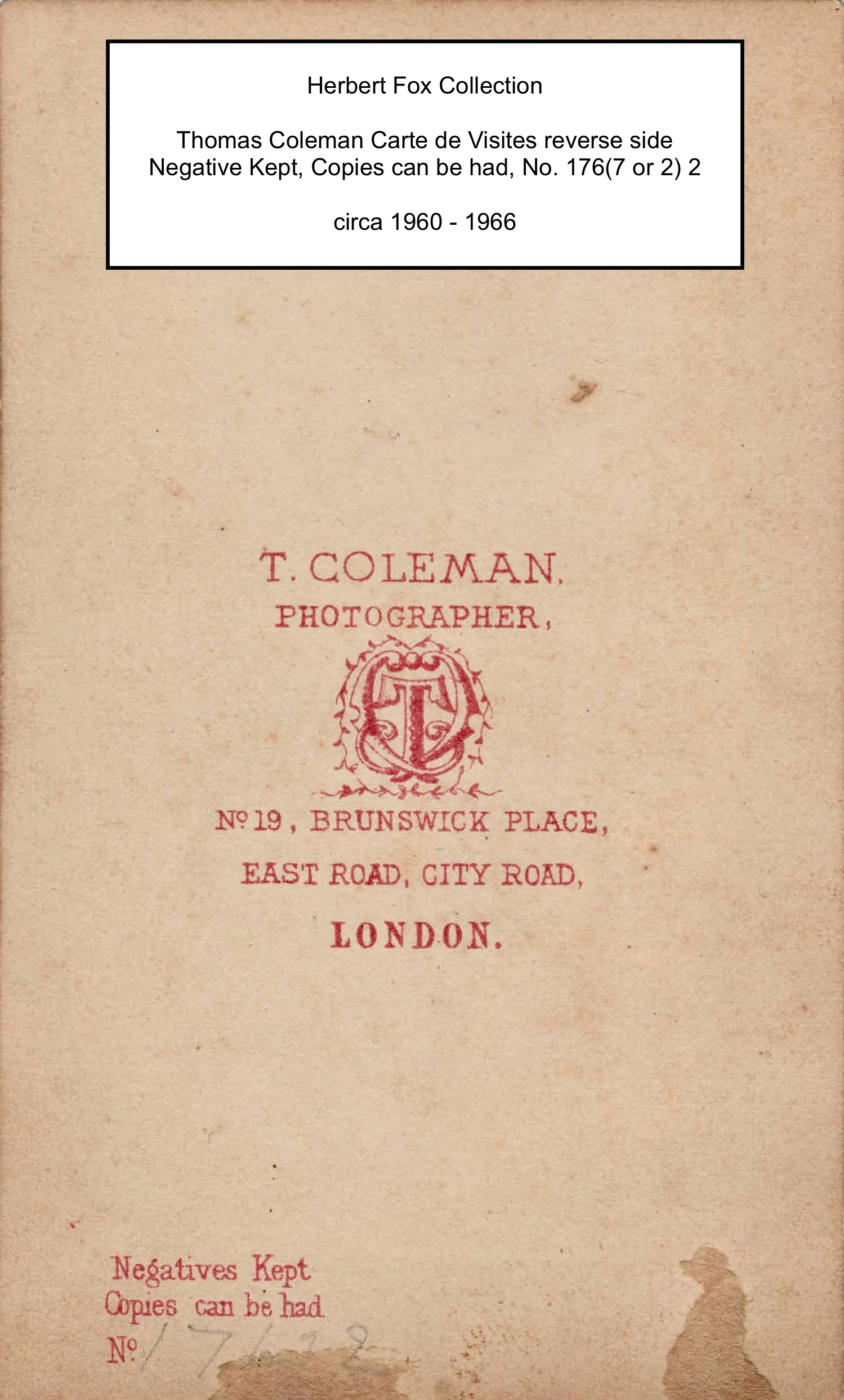 Below is a small photo found in Herbert and Eliza's documents. A CDV, or carte de visites, these photographs are no bigger than a few inches and were presented to family and friends when paying a visit. Larger Cabinet photos replaced CDVs.
Thomas Coleman was in business from 1860 to 1866, which rules out this pictured family unit as being anyone from the McCarthy/Moore/Sullivan/Hull groups based on the children's ages here, the girl looks about one year, and the boy about three-ish years old.
Perhaps close neighbours of William and Caroline gave this memento to them before they left for Canada. The family is beautifully attired, most notably the boy in a three-piece suit that has decorative stitching of fern motifs on each piece. This is a family from middle to high class that could afford to dress this well and also pay to have their photo taken.
The mother's eyes, and the boy's right eye have been touched up with ink to define the pupil.